
Explore the built environment of 18th-century Williamsburg and primary source documents in this interactive digital map to learn about the individual lives, the families, and the broader community of the Williamsburg Bray School. And discover how the legacy of the Williamsburg Bray School permeates Virginia's colonial capital, past and present.
This project was created in collaboration with William & Mary’s Bray School Lab , as well as the Historical Research, Archaeology, and Preservation teams at The Colonial Williamsburg Foundation.
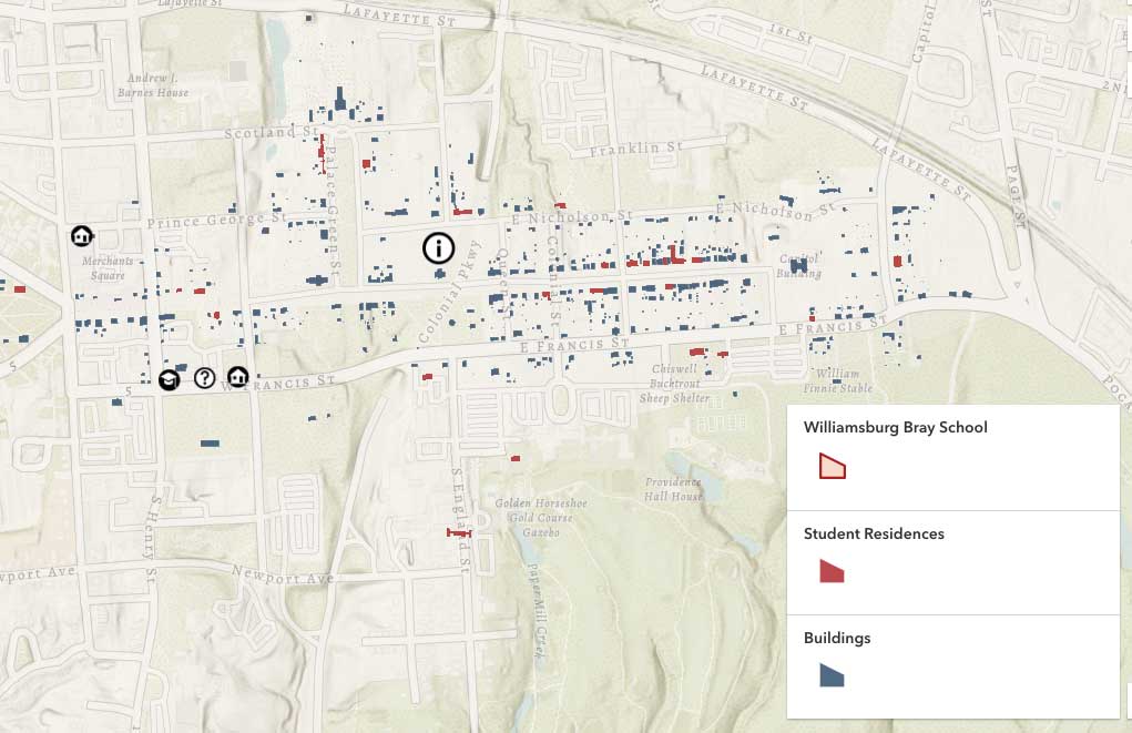
Click the map above to get started.
For optimal use, click here to open the map in a new window
The key is on the lower right side of the map. Icons in red identify buildings where Bray school students, parents, and enslavers lived. Icons in blue locate other buildings that were part of 18th-century Williamsburg. The building outlined in red identifies the original structure and location of the Williamsburg Bray School c. 1760-1765.
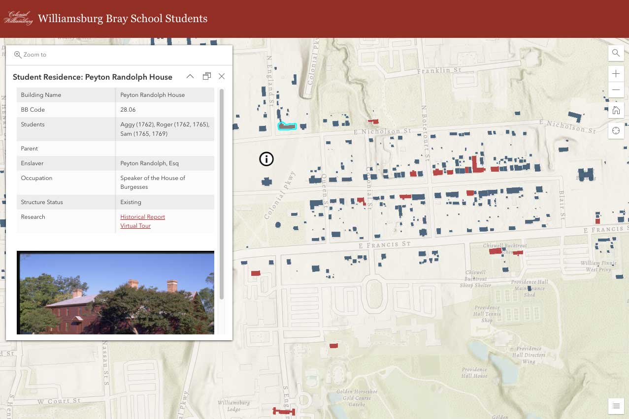
Clicking on a red icon will reveal current research information about Bray School students, enslavers, and other community members related to that specific building. It may also link to further architectural, archival, and historical resources. The following table explains how to read this information.
| Building Name | Modern Name of Building |
|---|---|
| BB Code | The Colonial Williamsburg Foundation architectural report block and building code |
| Students | Names of Williamsburg Bray School students and year(s) they attended |
| Parent | Parent(s) of Williamsburg Bray School student(s) |
| Enslaver | Individual(s) identified in Williamsburg Bray School records who sent children they enslaved to attend the Bray School |
| Occupation | Occupation of enslaver; status impacts lives of all living on property |
| Structure Status | Identifies whether the building is still standing or not |
| Research | Links to related research, scholarship, or digital resources |
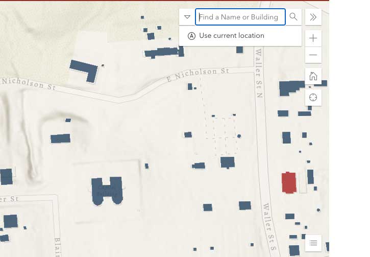
Quickly find specific names or buildings using the search tool in the upper right corner of the map.
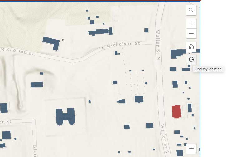
While visiting the Historic Area of The Colonial Williamsburg Foundation, use the location tracker to experience the town of Williamsburg through the lens of the Bray School community.
Researchers drew on primary source architectural, archival, and religious records as well as scholarly resources to populate this map. Key information about the Williamsburg Bray School students came from student lists, letters, and other documentary evidence in the collection of the Associates of Dr. Bray located at Weston Library, University of Oxford. Items in the John D. Rockefeller Jr. Library special collections, including correspondence, inventories, and county court records, revealed important details of community and life in 18th-century Williamsburg. Baptismal and death records in Bruton Parish Church’s Heritage Collection enabled researchers to identify the Williamsburg Bray School students’ parents. Research reports written by experts at The Colonial Williamsburg Foundation, demonstrated where students and enslavers lived as specific times throughout the latter part of the eighteenth-century in Williamsburg.
Founded in 2020, the Williamsburg Bray School Initiative is a collaboration between William & Mary’s Bray School Lab and The Colonial Williamsburg Foundation. The Initiative will use the Bray School as a focal point for research, scholarship, and conversation regarding the complicated legacy of race, religion, and education in Williamsburg and the larger United States.